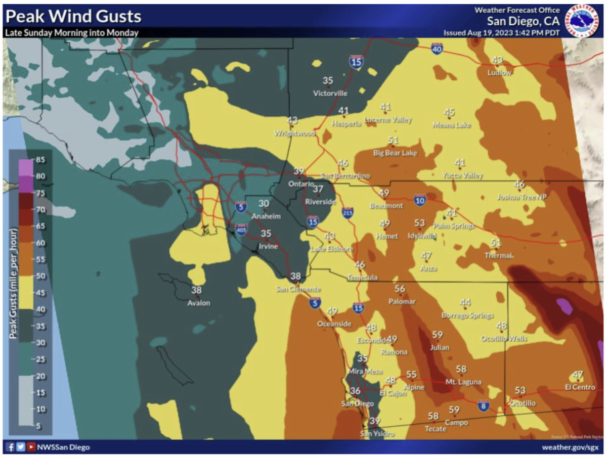
| Hurricane Hilary has sped up with the latest forecast as it approaches San Diego County. Heaviest rainfall for Southern California is now expected late tonight through Sunday evening, and the strongest winds are expected Sunday afternoon and evening. The National Weather Service (NWS) upgraded the status of Hilary from a Tropical Storm “Watch” to a Tropical Storm “Warning” last night for the first time ever in in this region. Although the storm has shifted course slightly to the east, it is still expected to impact the entire region with heavy rain and wind. Although the mountains and deserts are expected to bear the brunt of the storm, coastal areas will still see significant rainfall and high winds.
Rain Outlook
Hilary will bring moderate to locally heavy rainfall across areas west of the mountains Saturday evening into Monday. The heaviest rain will occur Sunday afternoon through Monday morning. The rainfall totals in our coastal areas is expected to be generally 1.5 - 2.5". Lingering showers and isolated thunderstorms will occur through Monday. Impacts: Numerous rain showers and isolated thunderstorms may produce heavy rainfall that will lead to localized flash flooding on roads and near property.
Timing: Today through Monday morning, with the heaviest rainfall Sunday Forecasted Rainfall: | 

No comments:
Post a Comment